The following figure presents an overview over the C++ classes of the sky module and their relations.
Sky module
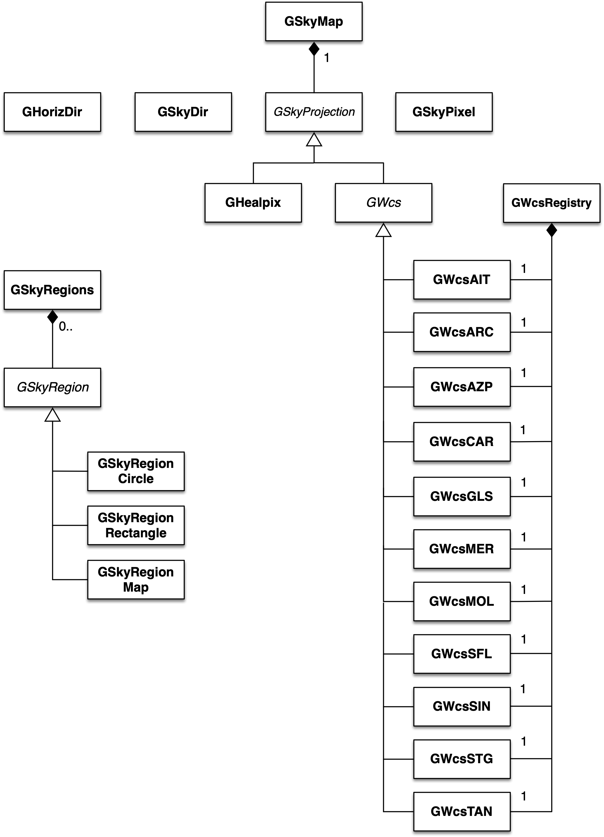
The sky module provides classes to handle sky maps, sky coordinates and sky regions. Sky maps are implemented by the GSkyMap class which stores intensities for a defined grid of sky coordinates. A GSkyMap object may hold several sky maps with identical pixelisation, for example to represent the energy-dependence of the sky intensities. The relation between sky coordinates and pixel coordinates is defined by the coordinate projection, represented by the abstract GSkyProjection base class. The derived class GHealpix implements the relation for the HEALPix pixelisation scheme, the abstract GWcs base class represents the relation for World Coordinate Systems. Specific World Coordinate System projections are implemented by the GWcsAIT, GWcsAZP, GWcsCAR, GWcsMER, GWcsMOL, GWcsSTG and GWcsTAN classes. Instances of all specific World Coordinate System classes are collected in the GWcsRegistry registry class.
Sky coordinates are implemented by the GSkyDir class that specifies celestial coordinates in either equatorial (Right Ascension and Declination) or galactic (longitude and latitude) coordinates. Transformation between both systems is handled transparently by GSkyDir. Sky map pixels are implemented by the GSkyPixel class.
Sky regions are represented by the abstract GSkyRegion base class. So far, only a simple circular sky region is implemented by the GSkyRegionCircle class. Sky regions are collected in the GSkyRegions container class.
Coordinates in the horizon system (altitude and azimuth) are implemented by the GHorizDir class.